Electrical Resistivity Survey
Advanced geophysical surveys to pinpoint optimal drilling locations with precision.
What is an ER Survey?
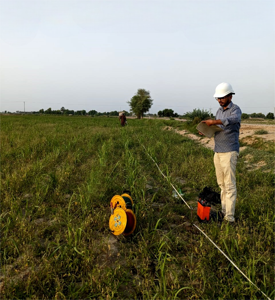
WSP uses Electromagnetic Resistivity (ER) surveys to map subsurface geology before any drilling begins. Our surveys identify aquifer locations, depth, and yield potential - saving time and cost.
We deploy state-of-the-art multi-electrode resistivity equipment operated by certified geophysicists. Data is processed using industry-standard inversion software to produce accurate 2D and 3D subsurface models.
- Aquifer depth & thickness mapping
- Optimal drilling site selection
- Reduces drilling risk and cost
- Certified geophysicists on every survey
Key Features
Site Assessment
Comprehensive pre-survey site evaluation and geological review.
Data Acquisition
Multi-electrode resistivity measurements across survey lines.
Data Processing
Advanced inversion software for 2D/3D subsurface models.
Reporting
Detailed technical reports with drilling recommendations.
Depth Analysis
Accurate depth-to-water-table determination.
Risk Reduction
Minimise dry-hole risk before committing to drilling.
Our Process
Site Visit & Planning
Field Data Acquisition
Data Processing & Modelling
Report & Recommendations
Related Services

Let's Build Something
That Lasts.
Pakistan's most trusted water engineering team - ready to assess your site, plan your project, and deliver results.